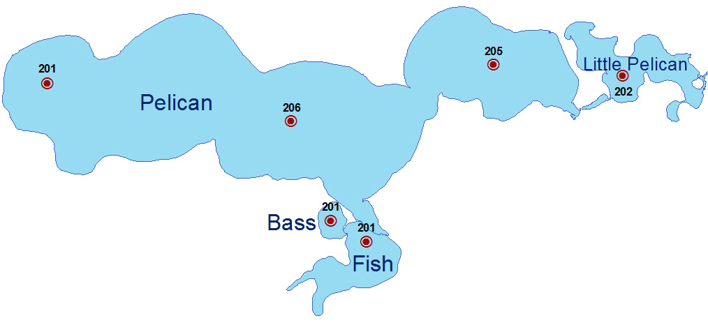
PGOLID

Pelican Group of Lakes Improvement District

Celebrating 25 Years

  • About Us
    • Charter
    • History
    • Financials
  • Meetings
    • Schedule
    • Agenda
    • Minutes
    • Annual Meeting
  • Programs
    • Aquatic Invasive Species
      • Curly Leaf Treatment
    • Education
    • Forest Protection
    • Let’s Plant Trees Project
    • Mosquito Treatment
    • Plant Surveys
    • Safety / Buoys
    • Past Programs
      • Fish Lake Dam
      • Shoreline Restoration
      • Septic Systems
      • Lake Modeling
  • Lake Management Plan
  • Water Quality
    • Lake Monitoring
    • Stream Monitoring
    • Lake Water Levels
  • Contact
    • Board Members
    • Lake Coordinator
  • PLPOA
  • Video
You are here: Home / Lake Monitoring

Lake Monitoring

PGOLID LAKE VITALS PELICAN LITTLE PELICAN BASS FISH
SURFACE AREA (ACRES) 3,961 366 51 293
MEAN DEPTH (FT) 22 10 18 27
LITTORAL AREA (%) 41% 70% 47% 43%
MAXIMUM DEPTH (FT) 55 25 33 69
VOLUME (ACRE-FT) 87,692 4,140 864 7,047
WATERSHED AREA (ACRES) 164,092 96,538 138 162,190
TROPHIC STATE INDEX (TSI) 42 50 43 40
TOTAL PHOSPHORUS MEAN (UG/L) 14.8 24.0 17.2 12.2
CHLOROPHYLL-A MEAN (UG/L) 3.5 8.1 4.1 2.6
CHLOROPHYLL-A MAXIMUM (UG/L) 13 31 17 8
SECCHI DEPTH MEAN (FT) 13.3 9.0 12.6 15.1

(more information coming soon)

QUESTIONS?

PGOLID Water Resource Coordinator
218-846-1465
pgolid@rmbel.info

MAILING ADDRESS

PGOLID
PO Box 336
Pelican Rapids, MN 56572-0336

WHERE WE ARE

The Pelican Group of Lakes is located in Otter Tail County, approximately 13 miles south of Detroit Lakes, and encompasses four lakes: Pelican, Little Pelican, Bass, and Fish.

WHO WE ARE

We are a lake improvement district, which means we are a taxing entity through the county. PGOLID was formed to identify, quantify, study, and manage water resources as to preserve quality.

Copyright © 2023 · Web Hosting by Absolute Marketing Group